Woods Hole Group
  • About
    • About UsWho we are and our offerings
    • Our HistoryLearn about our journey over the last 30 years
    • Meet our TeamMeet the leaders bringing us to the future
    • CareersJoin our team!
    • Woods Hole Group film Discover Woods Hole Group
  • Solutions
    • Environment & ClimateCoastal Engineering & Environmental Consulting Services
      Satellite Data Telemetry
      • Environment & Climate Consulting Solutions
      • Satellite Telemetry Solutions
    • Energy & InfrastructureOceanography & Measurement Systems/Surveys Metocean Forecasting
      • Metocean Consultancy Services
      • Metocean Measurement Services
      • Operational Metocean Forecasting Services
      • Metocean Monitoring Systems
      • Asset Tracking and Emergency Response Services
      • DeepCLidar: Floating LiDAR and Wind Resource Assessment
    • Sustainable Fisheries ManagementVessel Management Systems (VMS): Federal and Small-Scale Fisheries
      Fishing Intelligence Software and Fleet
      Data Management Solutions
      • Fisheries Solutions
      • Fisheries Products (Beacons, Softwares, FMC…)
      • Beacon Activation
      • Fisheries Dealers
      • NEMO Regional Programs
      • Customer Service & Vessel Documentations
    • Maritime SurveillanceMaritime Awareness Software
      Solutions Asset Tracking/Management
      • Maritime Domain Awareness
      • Maritime Compliance
      • Maritime Fleet Management
    •  
  • Innovation
  • Newsroom
  • Contact
  • App Access & Online Payment
    • Make an Online Payment
    • ArgosWeb
    • NEMO Activation Request
    • TRITON/LEO Activation Request
    • FAST Eddy Login
    • EddyWatch® Login
    • RouteWatch® Login
    • SurveyWatch℠ Login
    • ThoriumWeb Login
Select Page
Woods Hole Group – Satellite Telemetry

Woods Hole Group – Satellite Telemetry

Jan 26, 2024 | Environment & Climate, Environment & Climate Consulting Solutions, Satellite Telemetry Solutions

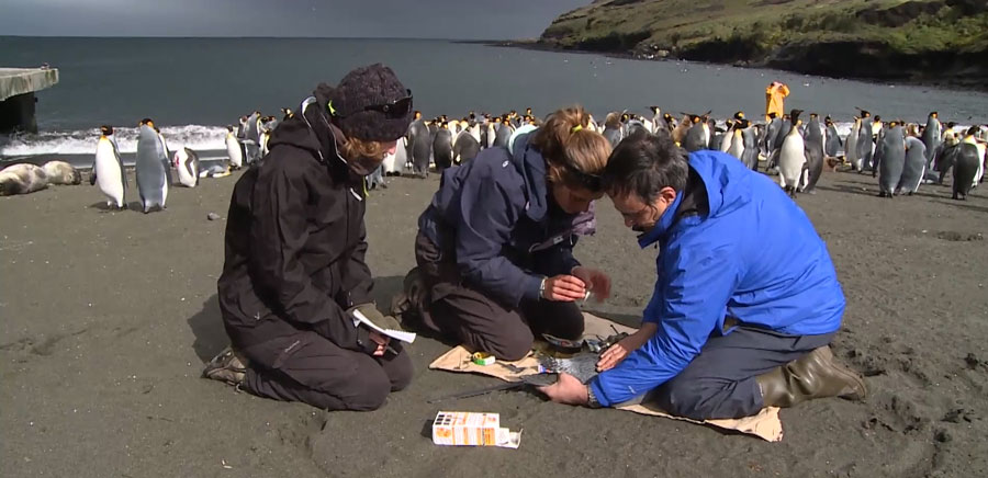
At Woods Hole Group, Inc. we are the unique Argos satellite system operator in North America. Argos is a unique worldwide satellite location and data collection system dedicated to studying and protecting the environment. Our Satellite Telemetry...
Debbie Stakem: A 32-Year Journey with Argos

Debbie Stakem: A 32-Year Journey with Argos

Nov 30, 2023 | Environment & Climate, Environment & Climate Consulting Solutions, Satellite Telemetry Solutions

An enhanced global system like Argos requires an enhanced global support team and, with its 30 different sites around the world, CLS is proud to have an excellent international userservices team. Debbie Stakem has been providing technical support to all North American...
Can the Cape’s continually flooded streets be saved? A first look at possible solutions

Can the Cape’s continually flooded streets be saved? A first look at possible solutions

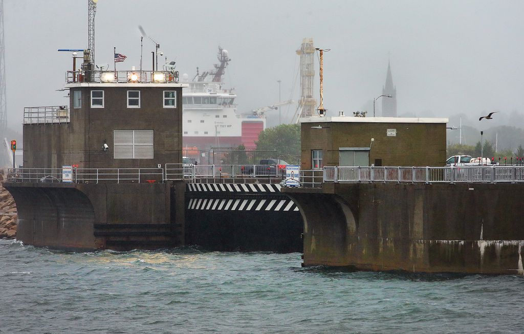
Mar 11, 2023 | Environment & Climate, Environment & Climate Consulting Solutions

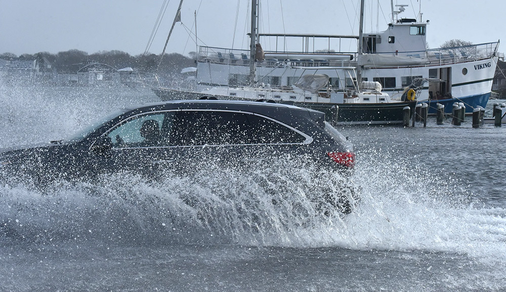
On Cape Cod, low-lying roads are especially vulnerable to changes in sea level, whether churned up by storms or as a result of longer-term rise and erosion. With an eye toward making the region’s roads more resilient to those changes, the Cape Cod Commission has...
Dune Restoration Study Funded For Stoney Beach In Woods Hole

Dune Restoration Study Funded For Stoney Beach In Woods Hole

Nov 1, 2022 | Environment & Climate, Environment & Climate Consulting Solutions

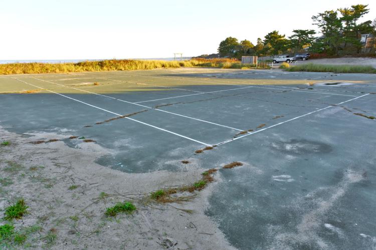
Resilient Woods Hole, a group working to prepare Woods Hole for the impacts of climate change, has received state money to pay for a feasibility study for dune restoration at Stoney Beach. Although a plan is not yet in place, a restoration effort would likely include...
Community and Climate Risk in a New England Village

Community and Climate Risk in a New England Village

Oct 14, 2022 | Environment & Climate, Environment & Climate Consulting Solutions

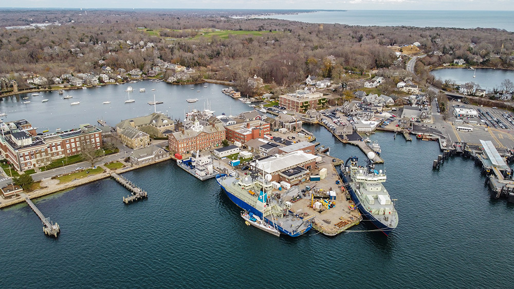
Woods Hole transformed from a whaling village to an ocean science research hub. Now, its next makeover involves a comprehensive climate change adaptation plan. Access the press article Main Photo: Eel Pond (background left) is a lagoon that connects to Great Harbor....
Sea level rise threatens New Bedford’s fishing port and could put South Coast towns under water, new report finds

Sea level rise threatens New Bedford’s fishing port and could put South Coast towns under water, new report finds

Sep 21, 2022 | Environment & Climate, Environment & Climate Consulting Solutions

Rising seas along the South Coast are projected to have catastrophic effects, inundating towns around Buzzards Bay and Narraganset Bay, flooding out roads, and wiping away salt marshes that store vast amounts of carbon, according to a new report. Access the press...
« Older Entries
Next Entries »

Recent Posts

  • Racing the Tides to Save Local Salt Marsh
  • 2026 Yarmouth Coastal Resiliency Fair
  • In Belize: NEMO is a Beacon for Sustainable Fisheries
  • Woods Hole Group Helps ONC Transmit BIG Ideas in Antarctica
  • A New Partnership Aims at Strengthening Coastal Communities

Recent Comments

No comments to show.

Subscribe to our  newsletter

Subscribe to our newsletter to be informed of our latest news.

Subscribe

Contact

107 Waterhouse Road
Bourne, MA 02532
United States
(508) 540-8080

Contact us!

Solutions

  • Environment & Climate
  • Sustainable Fisheries Management
  • Maritime Surveillance
  • Energy & Infrastructure

About

  • About Us
  • Careers
  • Meet our Team
  • Our History
  • Newsroom

Follow us on social medias:

  • Follow
  • Follow
  • Follow
  • Follow

© Woods Hole Group/CLS Group. For Earth From Space

  • Privacy Policy
  • General Conditions of Use
  • Cookies Management